TREE SURVEY and MANAGEMENT SOFTWARE
Improving Arboricultural Service Delivery with Digital Tree Mapping
Welcome to
Mapscape Tree Survey Digital Solutions
Mapscape brings together every aspect of tree surveying and tree data management in one intuitive platform, making arboricultural workflows faster, simpler, and more reliable.
Designed for efficiency, this UKRI Award-Winning, 100% cloud-based software helps organisations reduce costs, save time, and manage projects of any scale with confidence.
Trusted across the public and private sectors in the UK and Ireland, Mapscape’s easy-to-use digital mapping tools let surveyors work seamlessly on multiple projects while knowing expert support is always on hand.
If you’re seeking long-term value and dependable digital alignment, we’d be delighted to show you what’s possible. Ready to streamline your workflow? We’re here to help you get started.
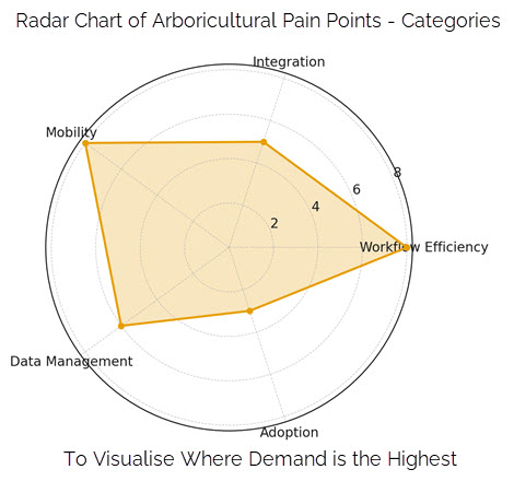
Solving Arboricultural Pain Points
Mapscape has been designed to solve these pain points. Built on Esri’s world-leading geospatial mapping software, it provides a robust yet intuitive platform that makes tree survey and data management faster, simpler and more reliable. Whether working alone or as part of a team, tree surveyors can collect, manage and analyse data seamlessly in one place, without the need to switch between multiple tools or worry about data compatibility.
The platform streamlines every stage of the process, from recording survey data in the field to generating outputs for clients or internal use. Tasks that once took hours can be completed in minutes, helping tree surveyors meet tight deadlines while maintaining the highest professional standards.
A Smarter Way to Manage Tree Surveys
Arboricultural surveyors work in fast-paced, demanding environments where accuracy, efficiency and clear data transfer are critical. Yet many tree surveyors still face the same challenges: time-consuming fieldwork, fragmented data entry, and the frustration of converting survey outputs into usable reports or shareable insights.
By combining cutting-edge mapping technology with a slick, user-friendly experience, Mapscape empowers arboricultural professionals to focus on what matters most: delivering accurate, timely insights and managing trees with confidence.

Tree Inventory & Asset Management
Everything you need to manage
trees, efficiently all in one place.
Ease-of-Use & Accessibility
Designed for both office and
field teams, with intuitive tools.
Integration & Data Handling
Can connect with QGIS, Power
BI and job management systems.
Expert Customer Support
Expert support to help you get
the most from your investment.
Addressing Arboricultural Pain Points
Our approach to solving industry challenges is grounded in in-depth research that identify and prioritise the issues that matter most to arboricultural professionals in the field, ensuring Mapscape directly addresses the pain points that impact your daily work.
- Tree Survey data flows seamlessly from the point of collection collection to the final Excel spreadsheet report without external processing, reducing human error and saving valuable time to deliver consistent professional results.
- At the core of Mapscape is integration with other applications such as ordnance Survey MasterMap, AutoCAD and specialist datasets to meet industry needs.
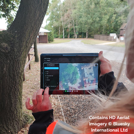
- Mapscape is optimised for mobile devices and supports voice input to accelerate data entry, so tree surveyors can work more efficiently in the field. Robust offline capability means poor signal will never interrupt your workflow; simply sync data back to the cloud when reconnected.
Discover what’s on the horizon with our forward-thinking development roadmap, offering a clear glimpse into the innovative features and enhancements coming your way.
Digital Tree Mapping, Made Easy
Smartphone-friendly with offline capability for professionals who need a straightforward, integrated tree survey and and data management solution for:
- Tree risk assessment from a single tree to an urban forest
- BS 5837 tree surveys
- Tree planting and establishment for replanting and community projects
- Automated carbon sequestration for green reporting
Improve Tree Management Data Transfer
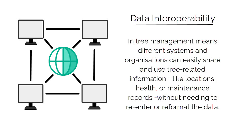
Mapscape is an Esri ArcGIS Online-based tree management software that offers significant advantages in interoperability. It enables seamless integration with other geospatial and asset management systems.
This enhances secure data transfer between departments and external stakeholders, reducing duplication and improving overall efficiency.
Interoperability supports shared data environments, encouraging collaborative approaches to tree management.
By operating within a secure, cloud-based infrastructure, Mapscape ensures data integrity and accessibility while supporting open standards, making it a robust platform for cross-sector geospatial collaboration.


